There are many phone apps available today which can help make your outdoor experience safer, and more enjoyable.
Now that we have more consistent access to reliable phone reception and wifi, along with a host of battery packs and solar chargers, it is now feasible to use these apps to help with outdoor trip and route planning, navigation, first aid and survival.
A word of caution though, many of the Apps rely on using your device’s GPS location and receiving data over the internet. During emergency incidents, these services may be unreliable and telecommunications systems may fail. You should not therefore rely exclusively on any single source of information such as theses apps. Use a variety of sources such as media, social media and government warning websites to obtain information on any incidents you encounter
There are a wide number of apps available for Navigation and maps, Emergency Alerts, Weather, Safety & First Aid, Photography, Plant and Animals, recipes and gear check lists.
Here is a list of some Apps you may find useful:
Must Have
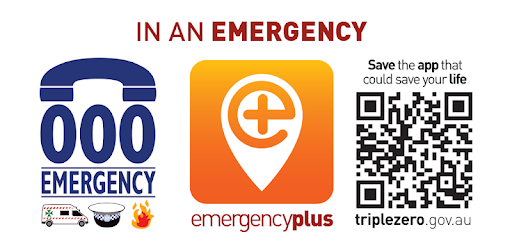
Emergency+ The Emergency+ app is a free app developed by Australia's emergency services and their Government and industry partners.
The app uses GPS functionality built into smart phones to help a Triple Zero (000) caller provide critical location details required to mobilise emergency services
Fires Near Me This app operated by the NSW Rural Fire Service provides information sourced from fire and emergency service authorities across Australia.
The app shows a number of different things, including: Burnt area- this is the last mapped area of the fire. Fires are mapped regularly but this does not show a live status of the fire, as it may have moved. Different coloured icons mean different alert levels of Advice, Watch and Act, and Emergency Warning. You can set up a watch zones
Weather
WillyWeather is a feature-rich weather app that provides detailed wind, rain, tide, swell and UV forecasts, as well as moon phases, and sunrise and sunset times.
BoM The Bureau of Meteorology is Australia's national weather, climate and water agency. Through regular forecasts, warnings, monitoring and advice spanning the Australian region and Antarctic territory, the Bureau provides one of the most fundamental and widely used services of government.
Red Cross First Aid This App is a free, comprehensive pocket guide to first aid and CPR, giving you access to the most up to date first aid information anytime, anywhere
Should Have
Vic Emergency App: VicEmergency is a centralised website for Victorians to find emergency information and warnings. You can also access preparedness and recovery information related to emergencies.
The website has a real-time map display with incidents across the state including floods, storms, fires, earthquakes, tsunami, beach closures, shark sightings and more.
Maps and GPS
Gaia GPS The free version of the app will let you check out a plethora of hiking trails across the country. The premium version lets you download all the maps so you can get where you need to be. If you won’t have service on your trip, the premium version also lets you view the topo, satellite or road map version of your route.
All Trails The trails on the app are curated by hikers and mountain bikers all over the country, so feel free to record, upload and share your own routes.
SunSmart provides sun protection times for more than 600 locations across Australia, providing an easy way to find out when you do and don’t need sun protection each day. You can set alerts to remind you when sun protection time's start each day, or set to be reminded about UV on any day of the week.
Nice to Have
Here are some apps that can be a bit of fun
SunSurveyor tracks the sun and moon to get that perfect shot. While it is designed for professionals to plan and capture that great shot, it is also great for keen photographers
SkyView or NightSky for those interested in knowing what is above your head
Peak Finder identifies over 350,000 mountains and hills worldwide
LeafSnap - just take a picture of a plant and the app will identify it for you. It claims to recognise 90% of known species of tress and plants
Trail Recipes - a US app for iOS only
iFunghiAU is a mushroom ID app
.